client: City of Gothenburg
team: Güller Güller architecture urbanism ZUS with Nüesch Development
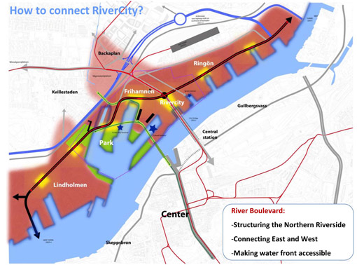
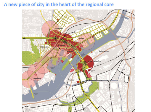
Today Frihamnen accommodates the main transportation corridor between North and South of the city of Gothenburg. The area is almost unused since the transfer of the port of Gothenburg towards the sea. It is a large land reservation, along the river and on the core of the Metropolitan area. The task of the team GGau-ZUS-Nüsch was to address the subject nodes and paths, corridors and axiss. Our approach was to say, No roads but streets in RiverCity 2021!
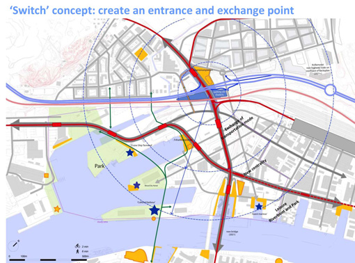
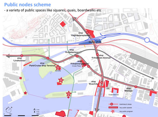
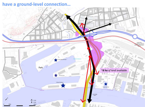
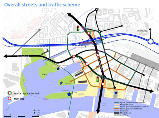
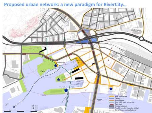
We developed several scenarios for the re-composition of the infrastructure in Rivercity, especially regarding the way the new bridge would land and how the public transports networks would be integrated on the public space of the future city. Next to that, how to organize a network of public spaces intrinsically linked with the movements of people and with the public transports nodes.
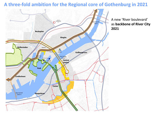
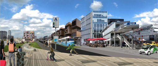
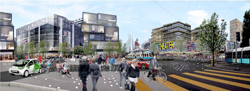
As a conclusion, we proposed a scenario which provided more value creation, but has theoretically a lower transportation speed on the north-south axis. However it could still offer a sufficient frequency (considering also the future ring structure > 2025). It integrates public transport visibly into the future city and provides a sounder basis of accessibility for RiverCity 2021. It made possible a multimodal avenue (north-south) rather than an urban thoroughfare. Public transportation becomes part of the urban space, and traffic flows are assured but do not create barriers. Multiple crossings assure the integration of River City 2021. Rather than dissociating and separating the different quarters, traffic flows provide a basis for concentration of density and program. And an enjoyable boulevard East-West as the new lifeline of RiverCity 2021, making the water visible and accessible. The River Boulevard and the tram Riverline are the lifeline of River City, directly connected to the new park, the cruise ship terminal and close to the waterfront of Göta Älv.
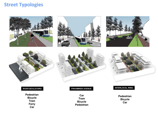
Regarding the public spaces , squares and streets where pedestrians, bicycles and clean modes of mobility are the main actors of the urban space, instead of vehicle traffic. Cars are allowed, but share space (as a new paradigm).
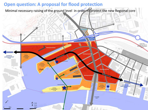
Phasing and flood protection where also addressed, in order to provide the city with a coherent framework to deal with the real questions of fighting the rising sea level.
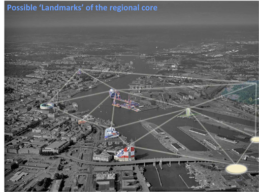
Value creation was achieved, on the overall scheme, with some key infrastructure elements integrated in an urban strategy (not dissociated from the urban planning process as usual):
Transfer hub
- Modal transport transfer at the gate of Göteborg from individual to collective transport system (+ pedestrian)
- Products highly compatible with environment (no more conflict): park & ride, suburban bus terminal, shopping mall, Volvo test drive on the top
Urban boulevard
- Urban boulevard with less individual transport thanks to the switch
- Products: Retail in the ground level, office (address creation)
River Boulevard
- Increasing the green line and water line combined with public transport (tramway)
- Products: Office, Housing, small shops
Duality between Destination and New Urban Space
- Potential already existing in the former harbor. Easy to introduce activity activating this quality as Destination: Park, Event, Exhibition in the old docks, etc
- Potential to be created along the heavy infrastructure axis north south by replacing with a thinner urban boulevard and creating quality with a New Urban Space.


Frihamnen
Gothenburg, SE, 2013
Gothenburg, SE, 2013