client: the Canton of Zurich (Tiefbauamt), Department of Civil Engineering
team: Güller Güller architecture urbanism, Synergo, Heierli Engineering AG, EBP, Metron
Zurich is in need of a long-term strategic solution for a series of major problems in town:
- thoroughfares with transit function are cutting through housing areas
- valuable river(side) spaces are occupied by infrastructures
- there are missing links for private and public transport between upcoming city hotspots / major development areas.
After years of indipendent studies, the city and the canton of Zürich and the Swiss Federation are approaching the issues together, with a project coordinated across all levels. In order to get beyond former studies, an integral view on the issues is necessary. This means combining the usual aspects of transport planning, civil engineering, and economic feasibility, with considering the environment, (local and large-scale) urban development triggered / induced, public acceptance, etc.
Double task: covering issues of urban planning...
GGau fulfilled a double task within this project. One task was to cover all issues of urban planning arising out of the various options studied, particularly also including opportunities for redirecting urban development and adapting the public space structure for the Zurich of 2030 by means of transport infrastructure.
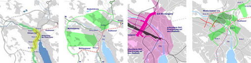
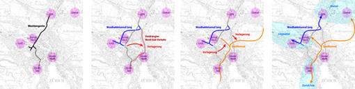
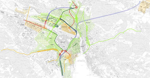
Today, there is one main thoroughfare crossing Zürich from the North to the South
(Westtangente). It faces growing capacity constraints. At the same time, the North
and West of Zürich (and to a minor extent also the South) are currently undergoing very strong development, creating new business and living areas of the range of mid-sized towns (50'000 inhabitants, 50'000 workplaces). The above-mentioned Westtangente is insufficient for providing capacity for the traffic induced by these developments, notwithstanding the fact that the main share (50%) of accessibility to the new developments is provided by public transport (against 30% by road and 20% by bike and pedestrian). Therefore, the current Westtangente is replaced by a triangular system directly linking the big development areas amongst each other and to the city center. The Stadttunnel (city tunnel) serves for connecting North to South (and for transit), the Waidhaldetunnel connects North and West, and the WestAst, a branch of the city tunnel, connects West and South. The city center is accessed via Westast and Stadttunnel.
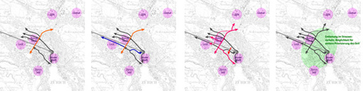
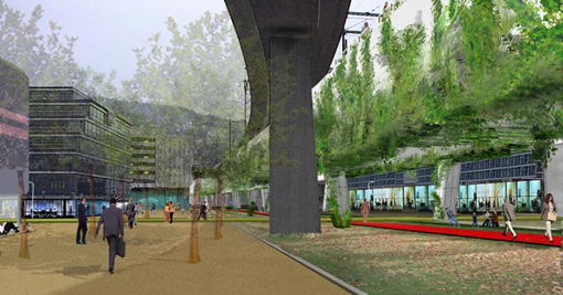
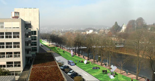
The main interventions being tunnels, the large-scale urban traffic and transit traffic disappears from surface, freeing valuable space for the revaluation of today highly disturbed urban districts and for the reclamation of river spaces for public use (parks etc.). Today's problematic on-grade thoroughfares can be downgraded and reduced in size, liberating capacities for slow traffic (bike, pedestrian) and particularly also for public transport, not least in crucial nodes where several lines meet.
...and condensing the complete project into an integral view on the evaluated solutions
The other, entirely strategic task was to integrate the various technical results of all fields of investigation into 'dossiers' on the different solutions for changing the infrastructure network, as a means of summing up all previous investigation, structuring detail research to come, and communicating the projects to the public in the sense of input to the political discussion. (see also publications)
Publication available at: Tiefbauamt der Stadt Zürich Baudirection Kanton Zürich
Neue Wege und Räume für Zürich
Zürich, Switzerland, 2004-2005
Zürich, Switzerland, 2004-2005